Railway Graph Polyline Editing Utility — all-in-one
This page is assembled from compact project documentation sections. Individual section files remain the source of truth; this page is for sequential reading, review, and PDF-style export.
Contents
- Summary
- Overview
- Context and Problem
- Goals, Requirements, and Constraints
- Role and Responsibilities
- System Model
- Architecture and Integrations
- Security, Quality, and Operations
- Decisions, Trade-offs, and Risks
- Roadmap and Demonstration
- Architecture Decision Records
Summary
Status
historical internal project / evolved into GraphMechanic concept
Role
initiator, concept author, developer
Stack
Type: Internal tooling / GIS data preparation / railway graph editing
Project value
A local web utility for creating, editing, and repairing railway track polylines used in railway graph data preparation.
What this demonstrates
This project demonstrates my early transition from requirements and data preparation work toward hands-on internal tooling development.
It shows the ability to:
- identify a repetitive data preparation bottleneck;
- convert a manual GIS/data-cleanup task into a visual tool;
- design a pragmatic internal application for a narrow operational problem;
- combine backend logic, map UI, routing, caching, and asynchronous interactions;
- create tools that reduce manual work and improve data quality.
The project later evolved conceptually into GraphMechanic, a broader idea for visual graph editing and GIS-related data tooling.
Overview
A local web utility for creating, editing, and repairing railway track polylines used in railway graph data preparation.
The project emerged from a practical data quality problem: railway infrastructure objects had to be connected with correct geometry, but manual preparation of polyline data was slow, error-prone, and difficult to validate without a visual tool.
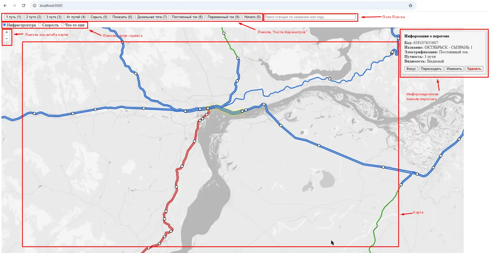
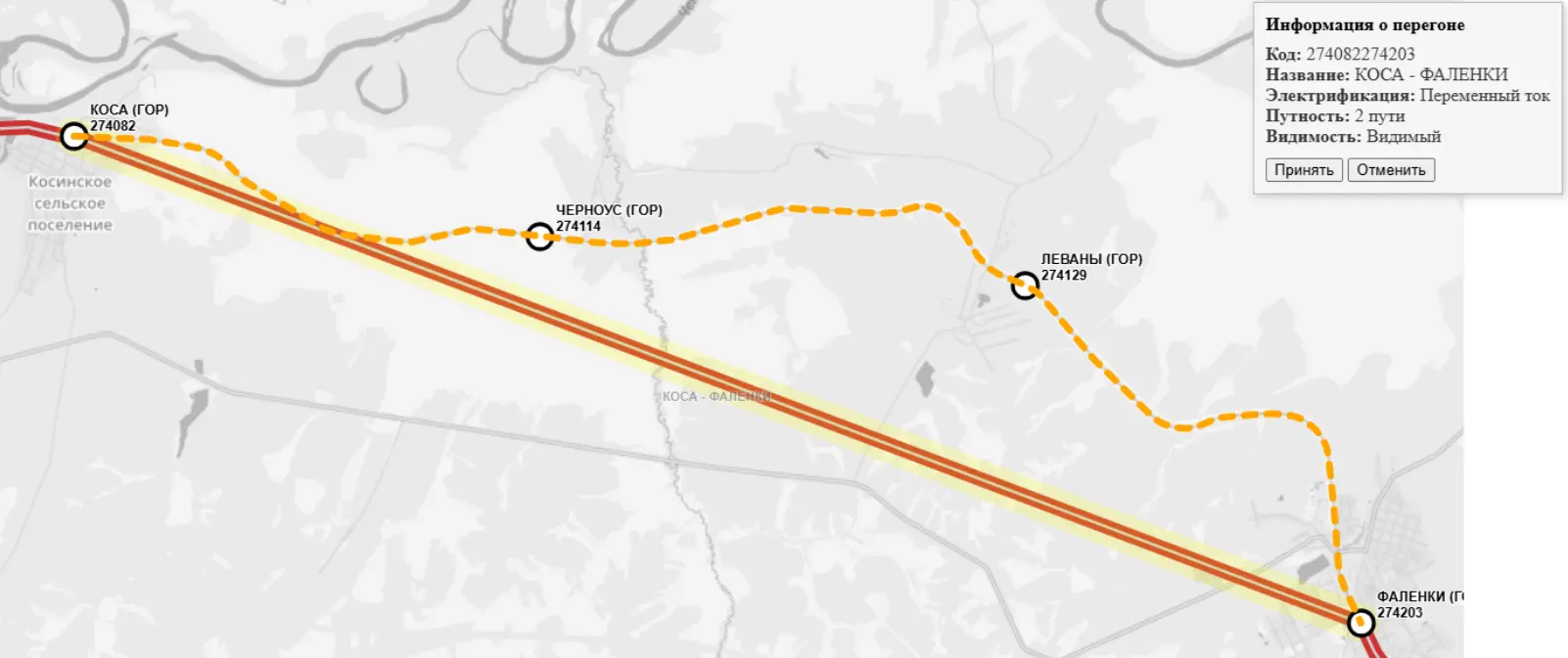
The utility provided a lightweight internal interface for working with railway graph geometry: editing nodes, creating polylines, generating route-based geometry, and repairing incorrect or incomplete track segments.
Technology Stack
- Java / Spring Boot
- Server-side rendering
- MVC architecture
- Repository layer
- JavaScript / jQuery
- Map-based UI
- Routing service integration
- Polyline caching
- Asynchronous data loading
Context and Problem
Context
The project was created in the context of an enterprise GIS initiative, where railway infrastructure data had to be prepared for map visualization, routing, and further analytical use.
Raw graph data and infrastructure objects required manual cleanup and alignment. Without a dedicated tool, this work would have required direct data manipulation, repeated checks, and significant coordination between analysts and developers.
The goal was to create a small practical tool that allowed visual editing and faster preparation of railway graph data.
Problem
The team needed to work with railway track geometry in a more controlled and visual way.
Typical issues included:
- missing or incorrect polyline geometry;
- disconnected graph nodes;
- railway segments requiring manual correction;
- difficulty validating geometry through raw data alone;
- slow preparation of infrastructure objects for further use;
- repeated developer involvement for data fixes that could be handled visually.
Goals, Requirements, and Constraints
Goals and Non-Goals
Requirements
I designed and implemented a local web utility for railway graph polyline editing.
The tool supported:
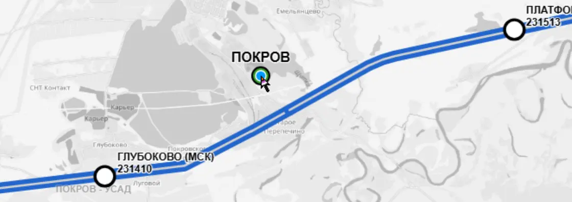
- viewing railway graph objects on a map;
- editing graph nodes;
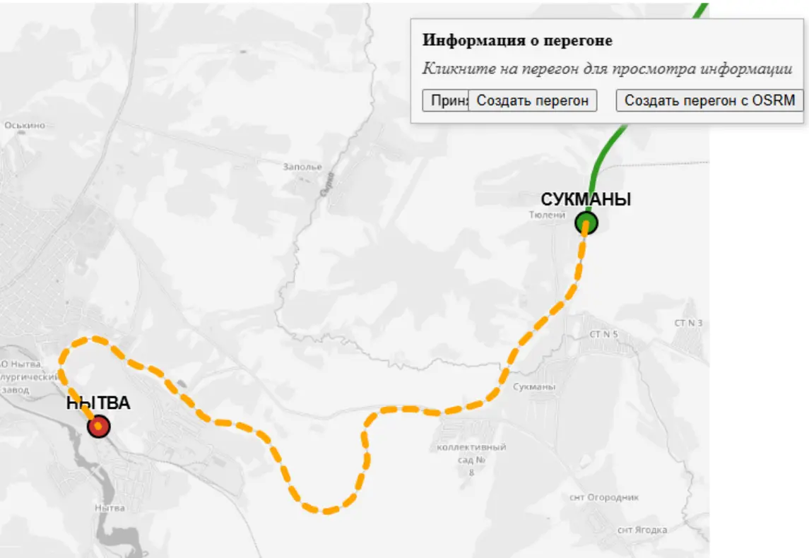
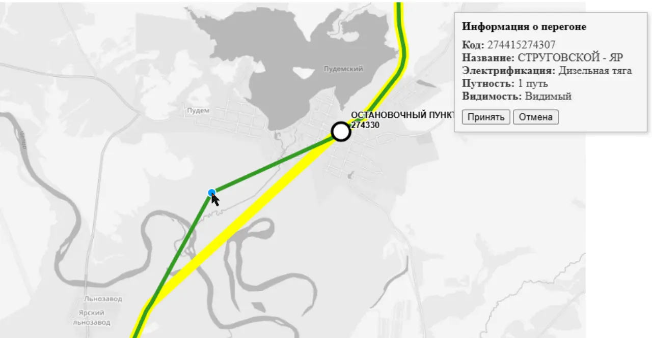
- creating new polylines;
- applying changes without full page reloads;
- preparing graph data for further use in GIS-related systems.
Constraints
Role and Responsibilities
I acted as the initiator, concept author, and developer.
My contribution included:
- identifying the need for a dedicated visual editing tool;
- defining the main user scenarios for railway graph cleanup;
- designing the application structure;
- implementing the backend and server-side page generation;
- implementing interactive UI behavior with JavaScript and jQuery;
- supporting practical data preparation work for railway infrastructure objects.
System Model
Domain Model
Data Model
API Contracts
Architecture and Integrations
Architecture
Architectural Approach
The utility was implemented as a layered monolithic web application.
The architecture included:
- server-side page rendering;
- MVC structure;
- business logic layer;
- repository layer;
- jQuery-based interactions for partial updates without full page reloads.
Integration Flows
Polyline generation via routing service
The tool generates polylines through a routing service, producing route-based geometry for railway graph segments.
Polyline repair via route recalculation
Existing polylines can be repaired through route recalculation when geometry is incorrect or incomplete.
Asynchronous polyline loading and update flows
The application supports asynchronous polyline retrieval and update flows, including polyline caching, enabling partial UI updates without full page reloads.
Security, Quality, and Operations
Security and Access Model
Non-Functional Requirements
Failure Modes
Sizing and Cost Notes
Decisions, Trade-offs, and Risks
Key Decisions
Trade-offs
Pragmatic local-only design
This approach was intentionally pragmatic: the tool was designed for local/internal use, fast iteration, and practical data preparation rather than long-term productization.
See also Architecture Decision Records.
Roadmap and Demonstration
Roadmap
- Documentation is in progress.
- The project direction continues in GraphMechanic: https://github.com/flatura/graphmechanic_docs
Screenshots and Demo
UI Screenshots
What This Demonstrates
This project demonstrates my early transition from requirements and data preparation work toward hands-on internal tooling development.
It shows the ability to:
- identify a repetitive data preparation bottleneck;
- convert a manual GIS/data-cleanup task into a visual tool;
- design a pragmatic internal application for a narrow operational problem;
- combine backend logic, map UI, routing, caching, and asynchronous interactions;
- create tools that reduce manual work and improve data quality.
The project later evolved conceptually into GraphMechanic, a broader idea for visual graph editing and GIS-related data tooling.